四面環海的台灣,百分之七十為山林覆蓋,島上子民珍惜每一塊可利用的土地,善用天然資源、創造豐饒。
FindARTs特與「看見.齊柏林基金會」合作,精選 齊柏林導演珍貴典藏,從雲嘉平原、關西聚落、到臨太平洋的九份山城,帶您從雲端視野,感受滿足。
Taiwan is surrounded by the sea and 70% of its surface area is covered by mountain forests. The people on the island have reaped the bounty of nature by treasuring every piece of land and making good use of natural resources.
FindARTs has partnered with the Chi Po-lin Foundation to present a handpicked selection of Director Chi Po-lin's classic aerial photographs. Seeing the Yunlin-Chiayi Plain, Guansi Settlement, and Jiufeng mountain town nestled against the Pacific Ocean from above is a very satisfying experience.
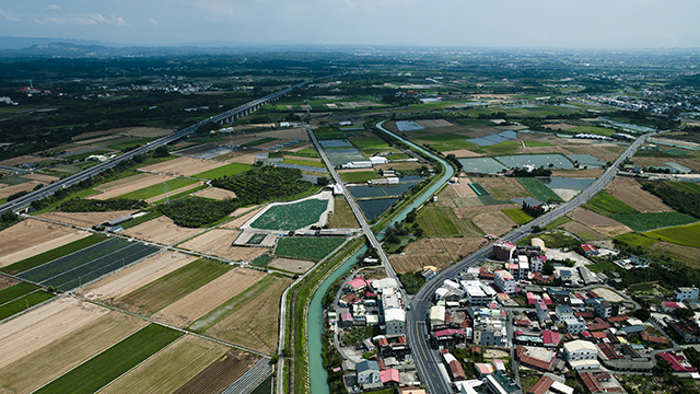
嘉南平原是台灣第一大平原,但早期因為缺乏穩定水源,不適宜耕種。直到1920年代,日本技師八田與一規劃興建烏山頭水庫與嘉南大圳,方能充分供水,使水稻面積從5,000公頃增加到15萬公頃,搖身一變成為「台灣穀倉」。
Chianan Plain is the largest plain in Taiwan. The lack of a reliable water supply hampered agricultural development in the region in the early years. This all changed in the 1920s when Wushantou Reservoir and Chianan Canal were designed and built by the Japanese engineer Yochi Hatta. Having a reliable supply of water saw the number of rice paddies jump from 5,000 to 150,000 hectares, turning the region into the "granary of Taiwan."

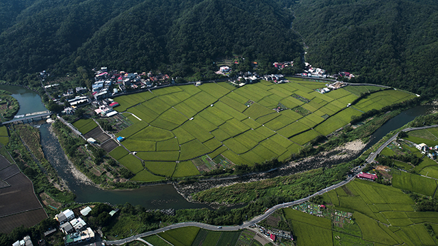
上南片位於新竹縣關西鎮的中部偏西,早在乾隆時期即有羅姓人家來此開墾,直至今日該地區羅姓仍占絕大多數。除了廣袤的綠野平疇,蜿蜒的鳳山溪等自然風光,該地區亦有百年三合院古厝「羅屋書院」,以及渡南古道,是遊客必訪之處。
Shangnanpian is located in the central-west of Guanxi Township in Hsinchu County. The Luo clan began settling in the region during the Qianlong Era and Lo remains the most common surname by far today. Local sights include the rolling green fields and winding Fengshan River. Other popular tourist destinations include the "Luowu Academy", a century-old courtyard house, and Dunan Historic Trail.

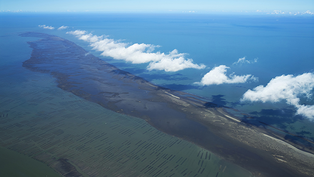
台灣西邊是平坦的陸棚海峽,且島上主要河流大多由西部入海,河川帶來的泥沙,日漸堆積成在河口形成的眾多沙洲。雲林、嘉義外海的外傘頂洲是台灣最大的沙洲,平均每年往西南方向往復漂移60至70公尺,被稱為「移動的國土」。
The west coast of Taiwan is made up of flat continental shelf. Most of the rivers on the island flow west into the sea as well. Mud and sand carried by the rivers are gradually deposited at the river mouths forming a multitude of sandbars. Waisanding Sandbar off the coast of Yunlin and Chiayi is the largest sandbar in Taiwan. On average, the sandbar migrates back and forth 60 to 70 meters in the southwest direction every year. It is therefore also referred to as the "Moving Homeland."

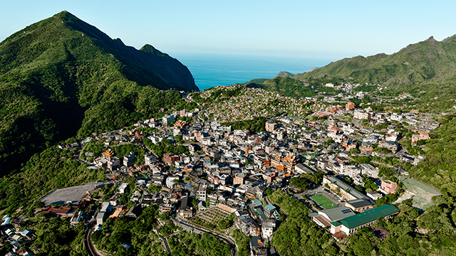
九份與金瓜石是台灣北部獨有的山城景致,從空中的視角讓一幅影像裡能有著山城與太平洋,早期以礦產開採為主,現以觀光維生,看出刻苦耐勞又堅毅的民族性,在基隆山與茶壺山交夾出的望海景致,實在難得。
The mountain town of Jiufen and Jinguashi make an unusual sight in northern Taiwan. From the air, we can see both houses on the hillside and the Pacific Ocean. In the early years, mining was the main industry here but this has now been replaced by tourism. Diligence and perseverance are embedded into the local psyche. The seaside views created by the way Mt. Keelung and Mt. Caohu press are a rare find too.

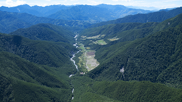
七家灣溪位於大甲溪上游,由於水質清澈,溪岸森林蔽蔭佳,水溫維持在攝氏16度的低溫,成為櫻花鉤吻鮭的最後棲息環境。櫻花鉤吻鮭屬於特殊的「陸封型」族群。而七家灣溪的族群是此類「陸封型」鱒魚分布的最南界,在生物地理學上有相當重要的意義。
Qijiawan River is located upstream of Dajia River. The crystal clear waters and forest foliage maintain the water temperature at a cool 16 degrees Celsius to form the last surviving habitat of the Formosan Landlocked Salmon (Oncorhynchus masou formosanus). Qijiawan River marks the southernmost distribution of the "landlocked" salmon and is of tremendous biological and geographical significance.

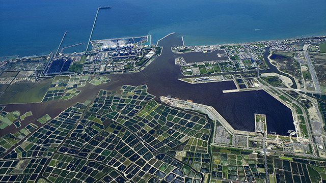
一塊一塊像是珍珠寶盒般的影像,是台灣高雄茄萣地區的魚塭,空中俯瞰如像閃亮寶石,美不勝收。然而台灣當前養殖漁業面臨著稱為「魚塭破碎」之嚴重問題,養殖魚塭遍布各地,衍生出不同的環境議題,值得重新省思。
The gems in the picture were actually a bird's eye view of fish farms in Kaohsiung's Jiading District. The aquaculture industry in Taiwan is however in crisis due to "Fish Farm Cracking." The proliferation of fish farms has also led to a host of environmental issues that require serious rethinking.
