在這板塊推擠中的小島上,海拔3000公尺以上的高山,超過了250座以上,形成特殊壯觀的地貌。 FindARTs特與「看見.齊柏林基金會」合作,精選 齊柏林導演珍貴典藏,從高山美麗的湖、峽谷風口、奔流赴海的高山河、到奇特巨岩的海岸,讓我們從空中視角,感受大自然的鬼斧神工。
This small island formed by tectonic action has a majestic geography dominated by more than 250 mountains over 3,000m in height.
FindARTs has partnered with the Chi Po-lin Foundation to present a handpicked selection of Director Chi Po-lin's classic aerial photographs. A bird's eye view of alpine lakes, windy mountain passes, alpine rivers rushing to the sea, and seashore formed by unusual great rocks are a testament to the handiwork of nature.
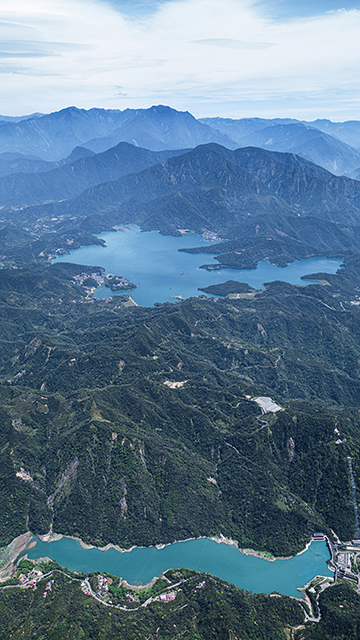
日月潭是台灣最大的湖泊,藉其地形優勢發展水力發電。明湖水庫便運用高度落差,儲存日月潭尖峰時段的發電用水,在晚間用離峰電力抽回,循環利用水資源。
Sun Moon Lake is the largest lake in Taiwan and its geography was exploited for hydropower. Minghu Reservoir uses the height difference to store water discharged by the Sun Moon Lake for generating electricity during peak hours. Water is then pumped back up to the lake using off-peak electricity at night for the circular reuse of water resources.

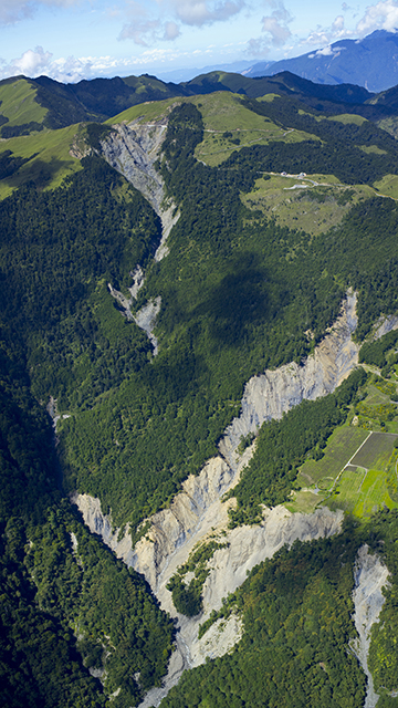
合歡山小風口是位於太魯閣國家公園,此處在大甲溪與立霧溪兩股上升氣流交織下的隘口,受到經常性的強風吹襲,才有了小風口一名。這裡在白天是觀察高山氣候與地形的絕佳場所,晚上則是觀星的據點,在齊導的空拍之下,顯得格外壯麗。
Xiaofengkou on Mt. Hehuan is located within Taroko National Park. Strong gusts of wind blow through the mountain pass here due to rising air currents from Dajia River and Liwu River, hence the name "Small Wind Pass." During the day, this is a superb location of observing the alpine climate and terrain. At night, it is a star-gazer's delight. The aerial photography of Director Chi add to the grandeur of Xiaofengkou.

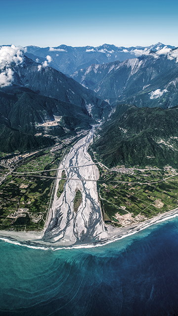
立霧溪從中央山脈蜿蜒前行,切割出地勢險峻的太魯閣峽谷,最後在花蓮縣注入太平洋,兩側的沖積扇平原是田野綿延的農村景緻,溪水在出海口前分合匯聚,空中俯視猶如長長的髮辮,好像自然的織物。
The Liwu River winds it way through the Central Mountain Range carving out the precipitous Taroko Gorge before flowing into the Pacific Ocean at Hualien County. Farming villages dot the alluvial plain on either bank. When the river waters meet again at the estuary, the view from above resembles braids of hair woven by Mother Nature.

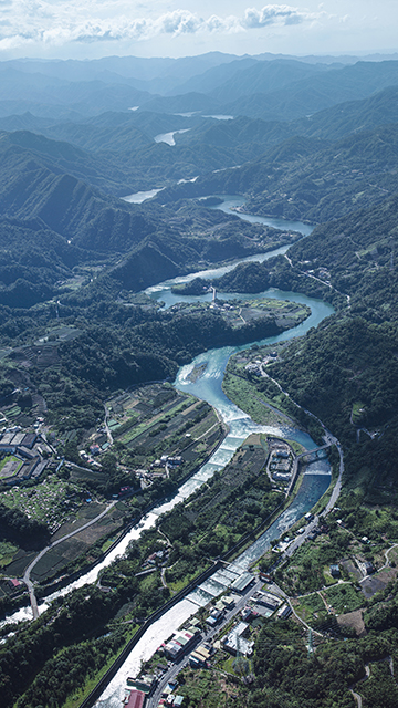
北勢溪源自雙溪區鶯子嶺,曲流地形發達,是翡翠水庫上游主流,也是坪林區主要溪流。坪林群山環繞,當地土質及氣候適合種植茶樹,使得茶葉成為當地特產,坪林老街即是以茶葉集散發展而成的老街。
The Beishi River originates from Yingziling in Shuangsi. It is the main catchment for Feicui Reservoir and the primary river in Pinglin District. Surrounded by hills, Pinglin's soil and climate is well-suited to growing tea, so tea leaf production is the main local industry. Pinglin Old Street itself began as a tea market.

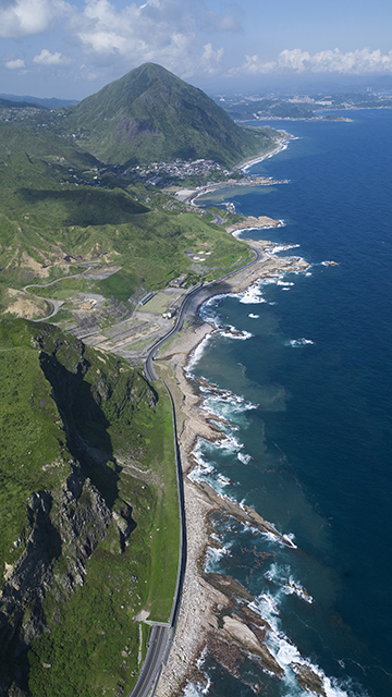
南雅海岸山勢陡峭,海蝕風化極為發達,因各層岩石的硬度與厚度不同,進而產生造形奇特多變的巨岩地貌,如霜淇淋岩、竹筍岩及海狗岩等。鬼斧神工的奇岩羅列交錯,與遼闊無際的湛藍大海構成北海岸數一數二的奇景。
The rugged Nanya Shore is the product of weathering and erosion. Differences in the hardness and thickness of each rock strata created many unusually shaped rock formations such as Ice Cream Rock, Bamboo Shoot Rock, and Fur Seal Rock. The endless expanse of open blue sea provides a perfect backdrop to these strange rocks.

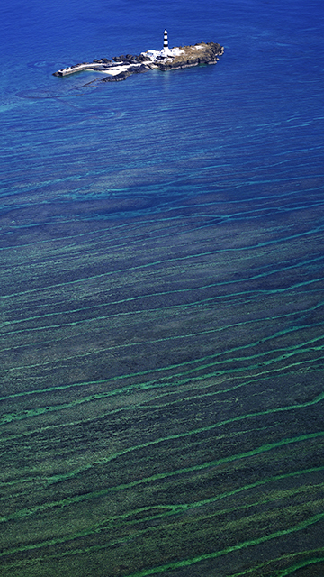
澎湖群島最北端的目斗嶼,全島由微輝長斑岩及玄武岩構成,其名來自岩層深黑色如墨斗,形狀從空中鳥瞰有如人的眼睛。約150年前,就已是吉貝居民的漁業場域,利用潮汐捕魚的石滬,與周圍豐富珊瑚礁群,融合成美麗的海中景致。
Mudou Island lies at the northern tip of the Penghu islands. The entire island is formed out of Dolerite and Basalt. The island was named after the inky color of its rocks and its eye shape from the air. The region has been a fishery for residents of Jibei as far back as 150 years ago. The stone weirs that use the tides to catch fish and the extensive coral reefs nearby form a jewel of the sea.
